
Today, let’s look at some hand(y) maps!
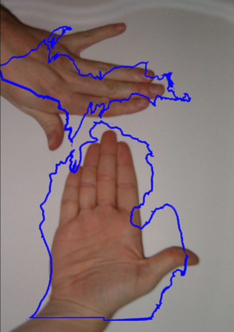
Michigan might have the best known hand map (at least for Midwesterners!).

But attentive readers will know that Alaska has a hand map, too!
Here are some other gems…
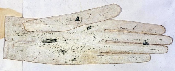
Map glove from 1851. (Via the Chicago Map Society Facebook page.)

1912.

From the 2013 exhibit “MAPnificent! Artists Use Maps.”

Reg Manning’s 1938 “Cartoon Guide to California.”
UPDATE:
From History of Cartography, Volume 2, Book 3, Chapter 4: “Maps, Mapmaking, and Map Use by Native North Americans” by G. Malcolm Lewis
UPDATE THE SECOND:
Two Wisconsin hand maps!


UPDATE THE THIRD: From the footnotes of someone who linked to this post, I can now add Tampa and the French front in World War IIhttps://www.theguardian.com/gnmeducationcentre/first-world-war-history-teaching-resource-gnm-archive?CMP=twt_gu!


Pingback: Handy Mnemonics: The Five-Fingered Memory Machine – Brewminate: A Bold Blend of News and Ideas